NORTH LOOP HISTORY
1930s / PRE-WAR
What we now call North Loop (historically known as "Northfield") was not so long ago sparsely populated land north of Austin. In the 1930s, a few suburban communities existed in this area. Ridgetop was a community separate from Austin (with their own school), and Fiskville was the last stop on the railroad before Austin.
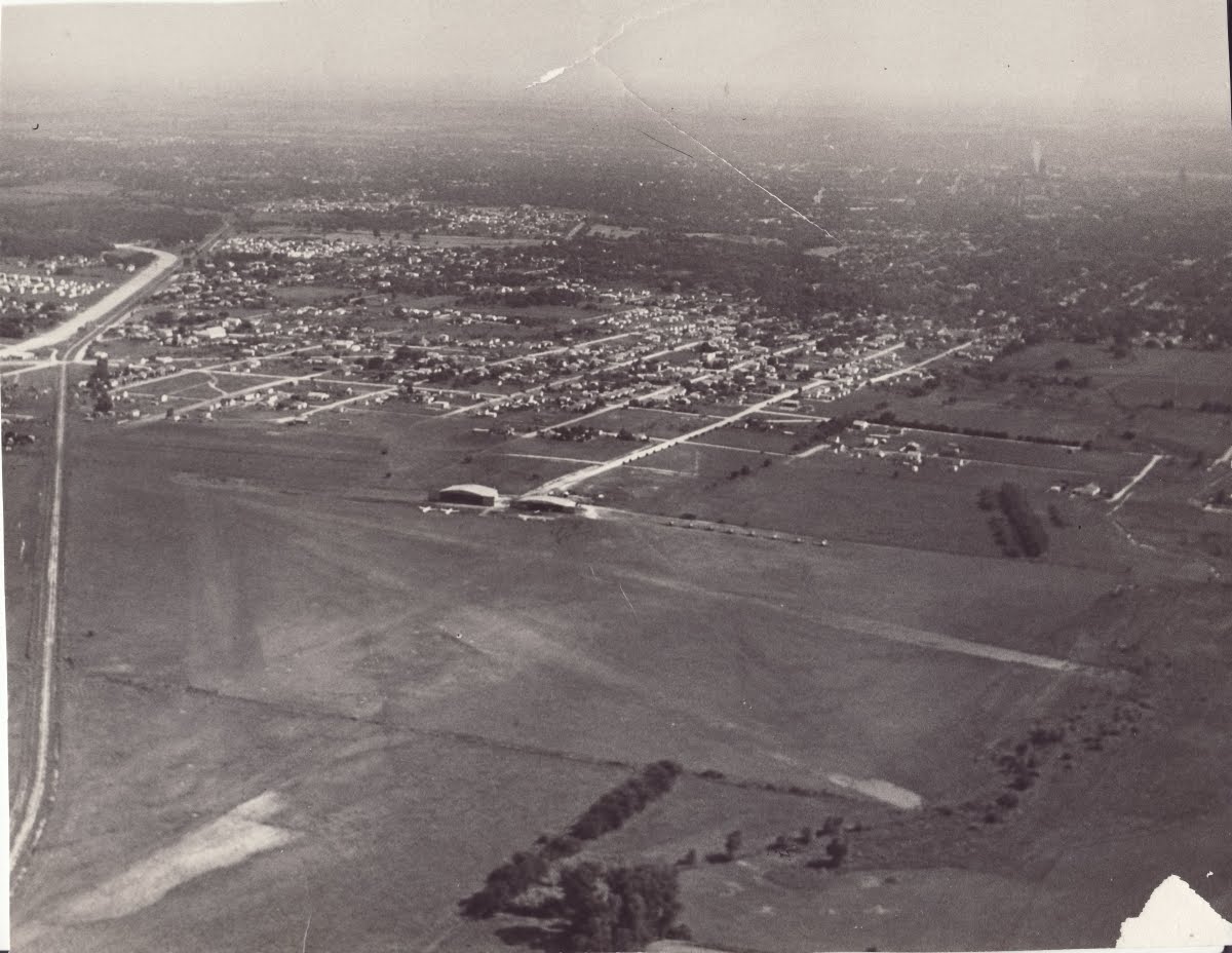
This aerial view taken above "Doc Haile's Airfield" must have been taken in the late 1930s. Railroad tracks run down the left side of the picture, and Avenue F simply ends at the Airfield. The diagonal street that connected 53rd with North Loop was still visible, and none of Dr. Koenig's land along Waller Creek had been developed yet. (Although there does appear to be a small orchard and a large building where Chesterfield Avenue ends at what is now Nelray.)
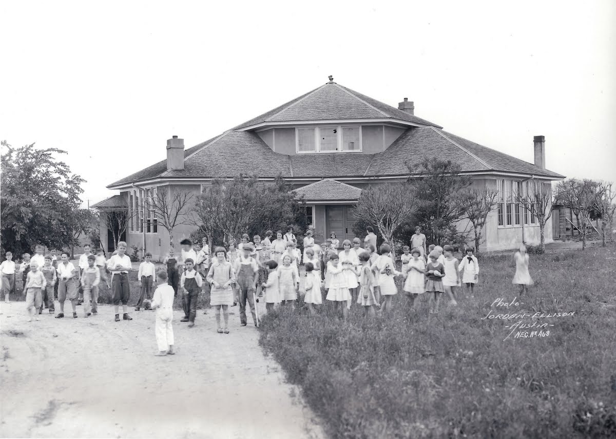
This is the original Ridgetop School. The current Ridgetop Elementary building dates back to around 1937, so this picture predates that.
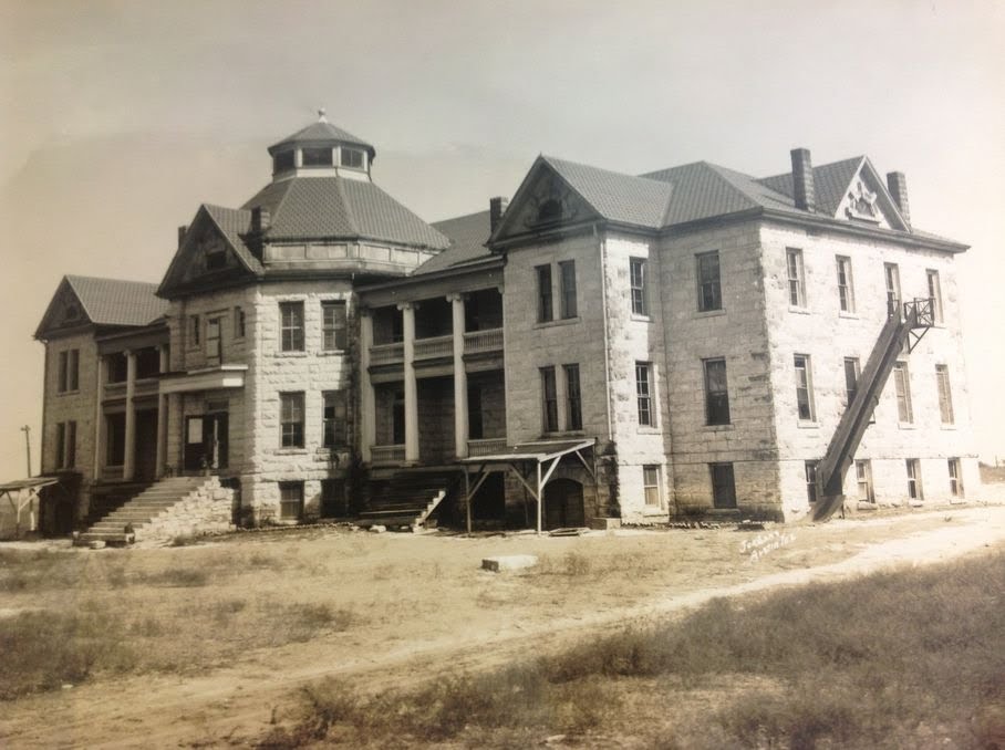
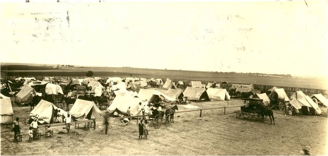
The St. Johns Community (an African-American Freed Slave community) owned a great deal of farmland on what is now Highland Mall. On that land in 1902, they decided to build an orphanage and school for African-American children. The orphanage thrived as a cultural center for the African American community until the Great Depression. For over 30 years after it closed, however, the limestone orphanage designed by notable architect John Andrewartha stood abandoned in the middle of a meadow next to the Tannehill Branch Creek.
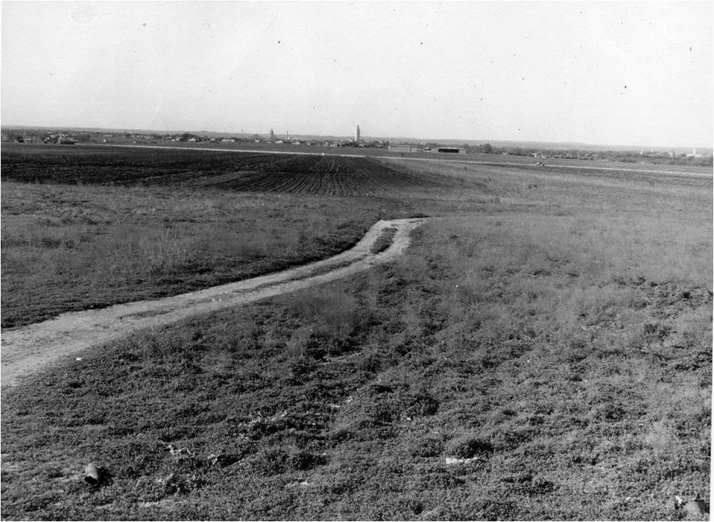
This view of Austin from the Orphanage give some perspective on life in this area prior to World War II. (Notice the airplane hangers at the corner of what is now Avenue F and Koenig)
African Americans regularly made a pilgrimage of sorts to Austin for an "encampment." Sometimes walking for many miles, African American Texans would come to Austin for a large conference and gathering that would last weeks. With no place to stay in town, they usually just slept in tents around the St. Johns Orphanage.
It is also worth noting that neighbors claim that the Orphanage and community graveyard was located at the top of the hill where St. Johns Street and I-35 cross. Supposedly graves were discovered when the highway and nearby businesses were built in the 1960s, but nothing was done about it.
AFTER THE WAR
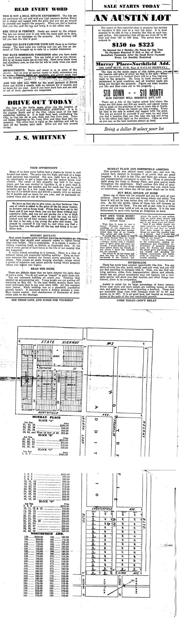
In the late 1940s, soldiers returning from war came to Austin to take advantage of the G.I. Bill that would help them go to colleges like The University of Texas. This sudden population boom called for more development of housing, and the automobile made developments like Northfield possible. Developers like J. S. Whitney advertised affordable lots in Murray Place and Northfield Addition that could be had for as little as $150.
Developers like J.S. Whitney placed flyers like the one above on car windshields to encourage people to come out and put "one dollar down" on a lot east of Dallas Highway (now Lamar).
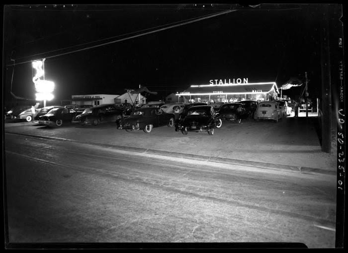
The area around Northfield went through some rapid changes, mostly thanks to the automobile. People regularly drove out the Dallas Highway (now called Lamar) to enjoy restaurants and take in a movie at the new invention -- the Drive In Theater.
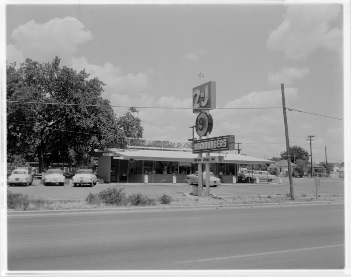
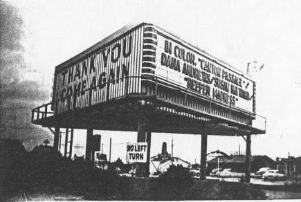
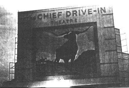
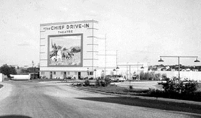
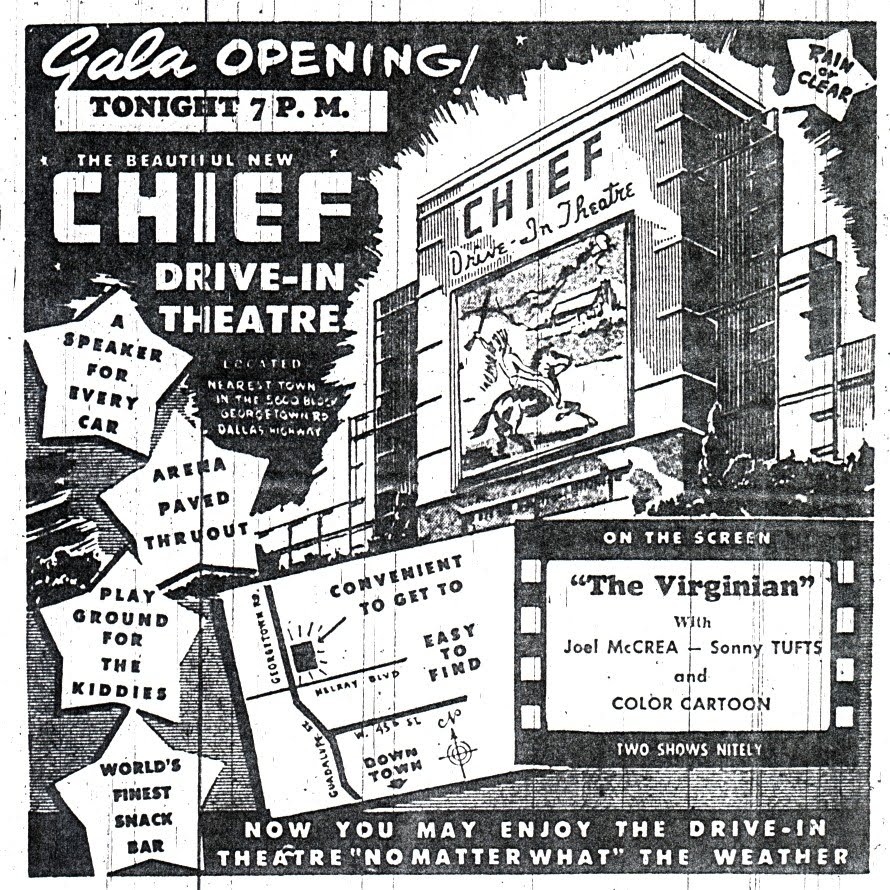
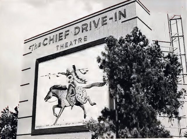
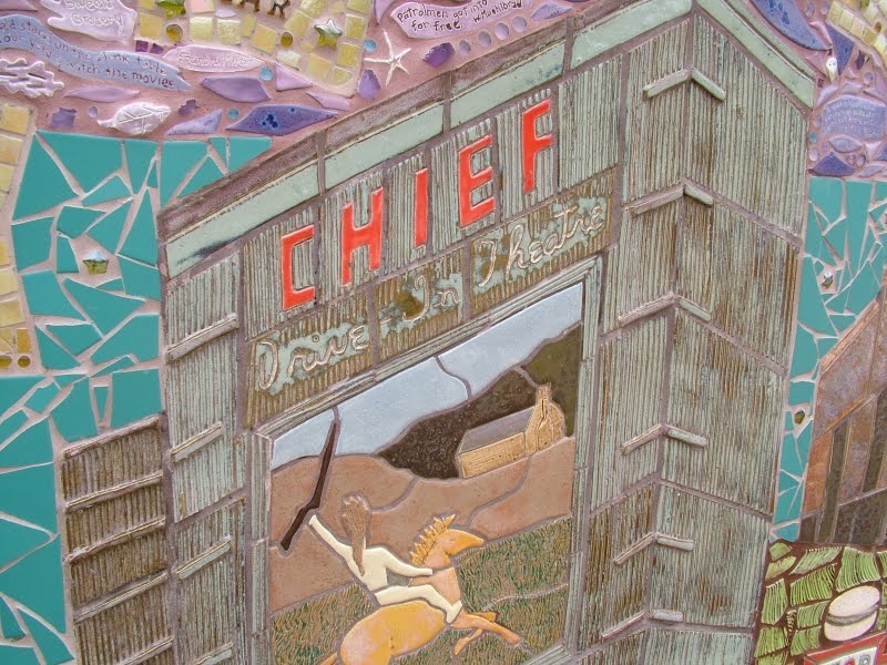
Road-houses like 2Js, The Stallion, and The Chicken Shack lined what was then called the Dallas Highway north of town (also known as "Georgetown Road"). Driving out of town on the highway, 2Js Hamburgers (home of the 19-cent burger!) was at 42nd Street, the Chicken Shack was at North Loop, and The Stallion was just south of Koenig, conveniently located right across the street from the Chief Drive-In Theater.
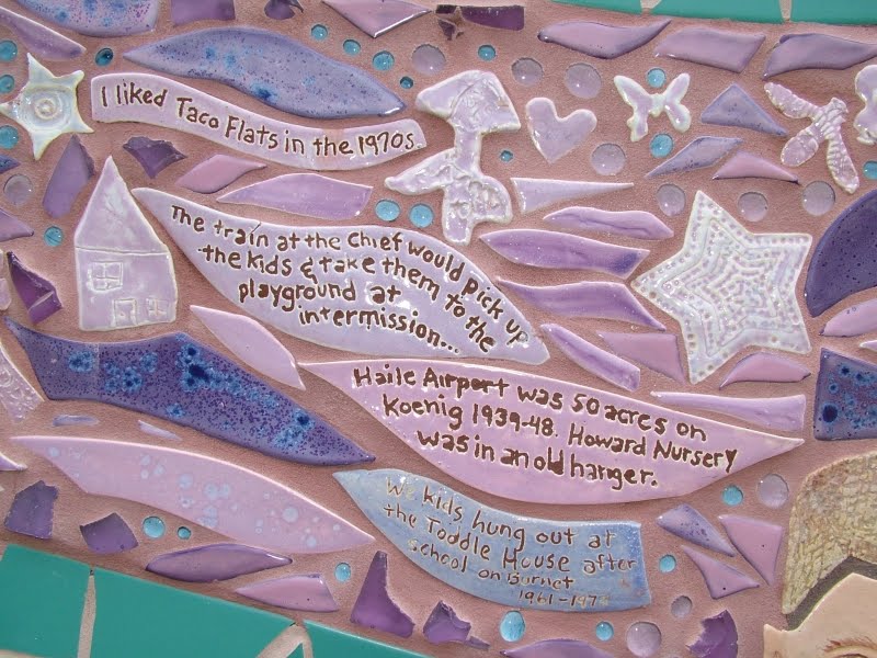
The Chief Drive-In advertised Color Movies in All Weather. (And who wouldn't want to see "Reefer Madness" at a drive in?) The "Gala" opening of the theater featured a showing of "The Virginian," which was released in 1946, along with a "color cartoon!" In later years, a small train circled the drive-in, and children could take the train to the playground.
1950s and 1960s - THE NEW SUBURBAN LIFESTYLE
As our baby-boom generation came of age, Austin grew to the suburbs north of town. People moved out of the city and enjoyed a lifestyle made possible by the automobile. In the 1960s, the wide boulevard east of town known as East Avenue was torn up to make way for the new Interstate Highway 35. A golf course owned by the Hancock family became a shopping center. The strip-mall with the grocery store anchor became the standard form of commercial development, and the indoor shopping mall became the best way to escape the Texas heat.
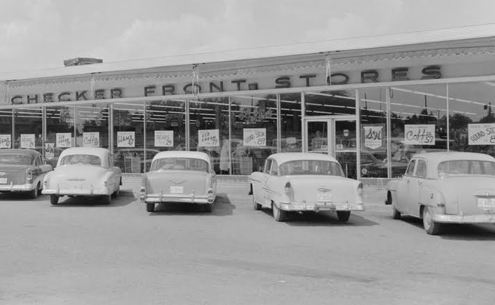
Checker Front Stores were some of the first "self-service" stores that allowed people to shop for their goods, and bring them to the check-out counter at the front of the store. The remains of a Checker Front Store can still be seen next to what is now Epoch Coffee. The store burned down, but the floor and even the remains of the old linoleum tiles can still be seen at the end of the shopping center.
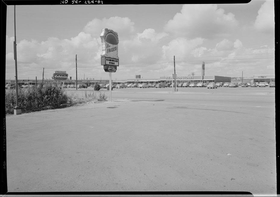
Nite Hawk "Frisco" restaurant across from HEB.
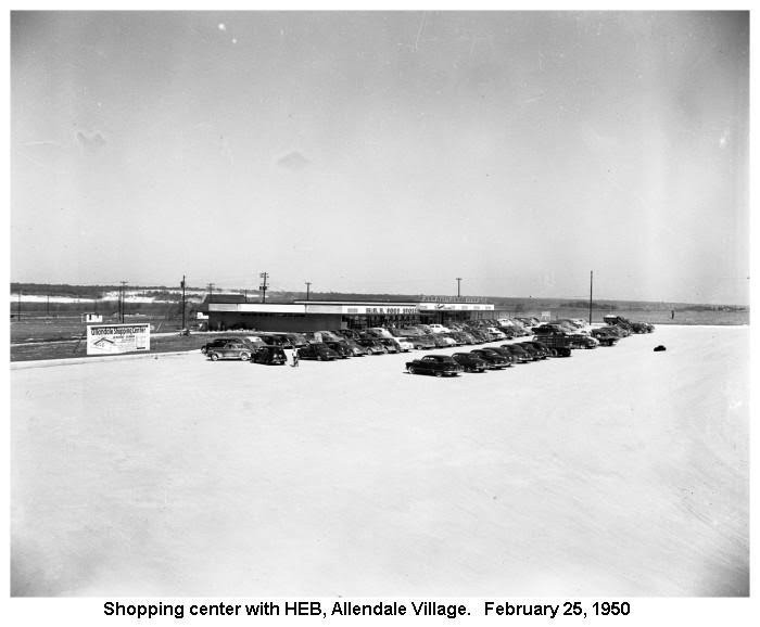
As indicated in the caption, this is the HEB at modern-day Burnet and Koenig. Note the flat expanse where all of Allendale sites today.
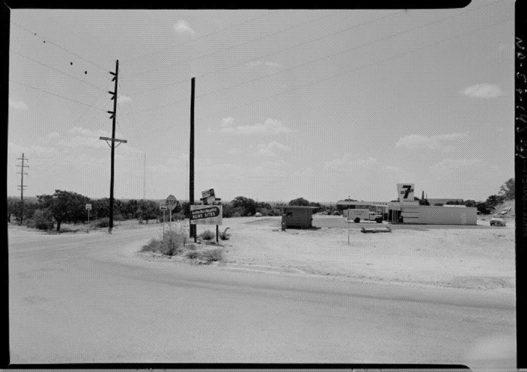
7-Eleven at the corner of Burnet and Koenig in 1950 (looking north)
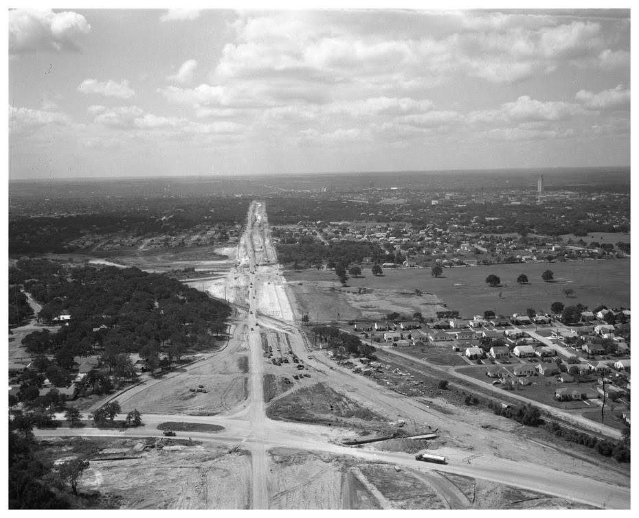
In 1960, what was once the intersection of East Avenue and Austin Loop 111 became the intersection of I-35 and Airport Boulevard.
1970s-1980s
As the neighborhood filled-out, it attracted memorable restaurants and businesses. One such institution was "Scampi's Organ Palace." Scampi's was located at the southeast corner of Koenig and Lamar (the same lot currently occupied by the Goodwill / Half-Price Books strip center). For entertainment, Scampi's featured magicians, jugglers, comedians, flashing lights, balloons, bubbles, a cymbal monkey named Scampi. Scampi's centerpiece was a huge Mighty Morton theatre pipe organ, and patrons were treated to regular organ interludes as they enjoyed their pizza.
Long-term residents have fond memories of Scampi's and reminisce about the pizzeria (and the monkey) to this day.
An old clip from Channel 24 "Action News" about Scampi's.
PRESENT DAY
The rest, as they say, is history. Austin continued to grow, doubling in size every 15 years. The suburbs of the 1950s became part of the urban core. Suburban-style shopping like Highland Mall and Hancock Center thrived and then decayed. The Drive-In theater became a relic of the past, and the Chief became an office-park. The Chicken Shack became a vacuum cleaner store, and then a Taco Cabana. The Mueller Airport became the Mueller neighborhood, and Northfield came out of the "flight-path" and became the trendiest, coolest place to live in all of Austin.
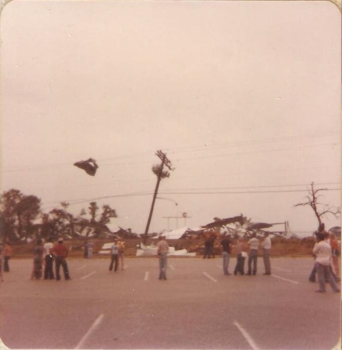
The aftermath of a tornado that touched down in Mueller Airport in 1980.
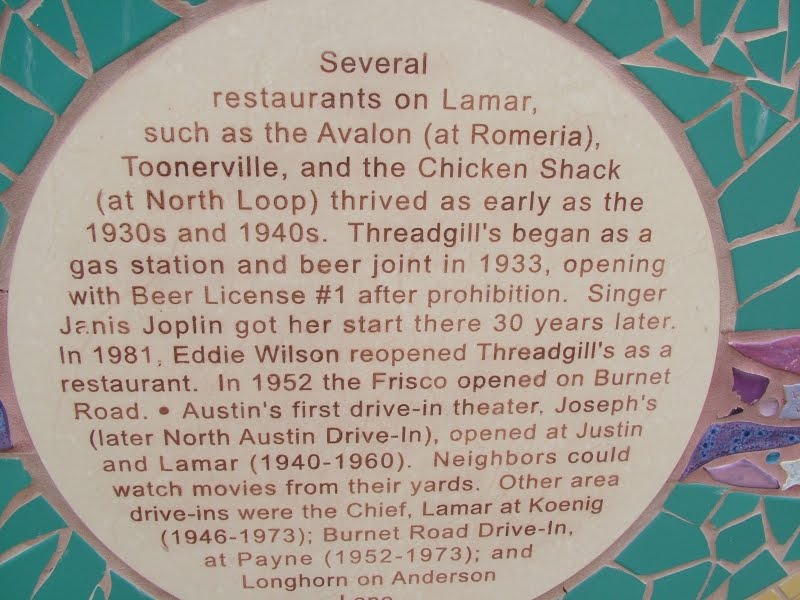
Memories on the "Memory Wall" by the Crestview shopping center.